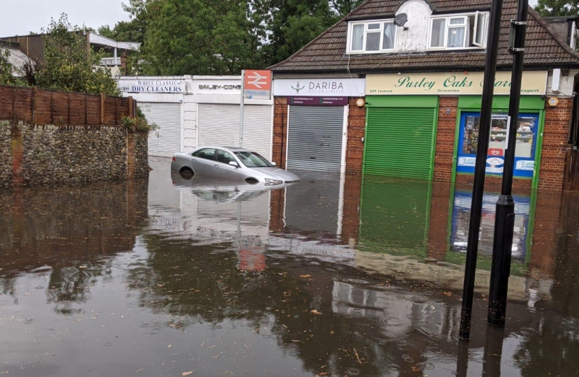
There has been considerable flooding on the east-side of Purley Oaks Station this week. This isn’t a rare event, and the perception is that it is getting worse.
This morning I have seen a video of water flowing at speed from Purley Oaks Road into the access area in front of the shops and towards the underpass under the rail tracks. Commuters had to remove their shoes and roll-up trousers to get out of the station. I have also seen videos and photographs of the area behind the hoardings that runs down the back of Norman Avenue towards Derrick Avenue, which is now being developed into 37 new homes. This area was substantially flooded and would have been even further impacted if the hoardings hadn’t been holding back some of the water. Which of course begs the question as to how the Labour-dominated Planning Committee came to approve the building of 37 homes on that strip of land. Not only will this make matters worse for existing residents, commuters and business owners, it’s hard to imagine how it can be acceptable to build homes that are likely to flood.
I visited Purley Oaks Station today; The water line was about 70cm against shop windows and business owners talked about the work they had been doing to clear up both the inside of their own units and the walk way to the station as Council staff had not been involved in the clean up operation.
I have contacted Council officers to arrange to discuss a longer-term flood alleviation plan. This will take time to formulate, especially as a number of organisations need to be consulted. In the meantime, if you spot blocked drains in the near vicinity, but also higher up, do report them via the ‘Love Clean Streets’ app. This area is relatively low lying; blocked drains a mile away can contribute to the speed of the flow that we saw on Thursday.


